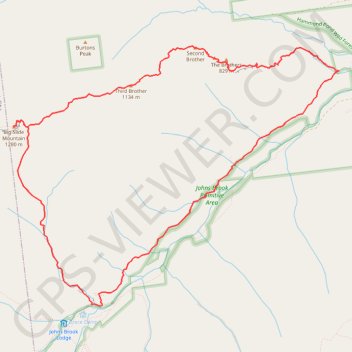
Big Slide Mountain Loop
Lop hike from Garden Parking to Big Slide Mountain via Phelps Trail, Big Slide Trail, The Brothers Trail, Third Brother, Second Brother and First Brother in the High Peaks Wilderness. #Hike #Loop #Mountain #Nature #Wilderness
- Distance : 14,5 Km
- Dénivelé positif : 855 m
- Altitude maximum : 1 252 m
- Dénivelé négatif : 855 m
- Altitude minimum : 473 m
- Temps en mouvement : 6 h 25 m
- Vitesse en mouvement : 2,2 Km/h
- Vitesse maximum : 5,4 Km/h
- Temps total : 8 h 33 m
- Vitesse globale : 1,7 Km/h
- Date : 07/07/2022
Carte interactive
Profil de la trace GPS
À propos de cette trace GPS
Nom : Trace GPS Big Slide Mountain Loop, itinéraire, parcours
Coordonnées : 44.16052 -73.87097 44.19188 -73.81608
Autres traces GPS
Cliquez sur une trace GPS pour visualiser son itinéraire, ses statistiques et son profil.
Saddleback Mountain
United States > New York > Essex County > Town of Keene
Hike from Garden Parking Area to Saddleback Mountain via Phelps Trail, Orebed Brook Trail and State Range Trail in the Johns Brook Primitive Area, the High Peaks Wilderness and the Adirondack Park. #Hike #Mountain #Nature #Forest #River #Park #Wilderness
Distance : 24,5 Km • Dénivelé positif : 1 085 m • Altitude maximum : 1 361 m
Montréal - New York
Canada > Québec > Agglomération de Montréal > Montréal
Distance : 637,3 Km • Dénivelé positif : 4 134 m • Altitude maximum : 301 m