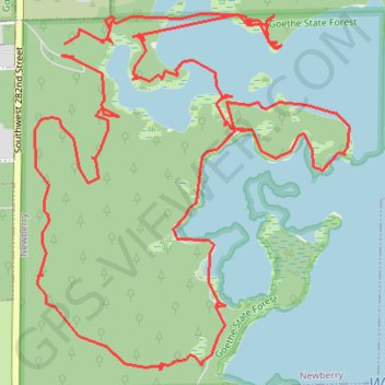
Goethe Forest and Watermelon Pond Loop
Carte interactive
Profil de la trace GPS
À propos de cette trace GPS
Nom : Trace GPS Goethe Forest and Watermelon Pond Loop, itinéraire, parcours
Départ : Southwest 282nd Street, Newberry, Alachua County, Florida, United States (29.56476 -82.63755)
Arrivée : Southwest 282nd Street, Newberry, Alachua County, Florida, United States (29.56427 -82.63712)
Coordonnées : 29.55193 -82.63885 29.56592 -82.62464