Dix Mountain Loop
Loop hike on the Dix Range via Boquet Forks Trail, Shoebox Falls, Lillypad Pond, Grace Peak, Grace Peak Trail, South Dix Lookout, South Dix, Dix Range Trail, Macomb Mountain, Hough Peak, Beckhorn Trail, Dix Mountain, Dix Trail and Round Pond in the High Peaks Wilderness and the Adirondack Park. #Hike #Loop #Mountain #Lake #River #Forest #Nature #Wilderness #Park
- Distance : 27,1 Km
- Dénivelé positif : 1 577 m
- Altitude maximum : 1 456 m
- Dénivelé négatif : 1 493 m
- Altitude minimum : 403 m
- Temps en mouvement : 9 h 54 m
- Vitesse en mouvement : 2,7 Km/h
- Vitesse maximum : 5,4 Km/h
- Temps total : 11 h 23 m
- Vitesse globale : 2,4 Km/h
- Date : 22/07/2022
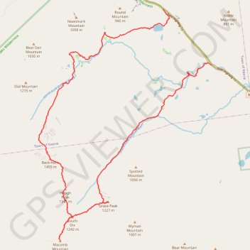
Carte interactive
Profil de la trace GPS
À propos de cette trace GPS
Nom : Trace GPS Dix Mountain Loop, itinéraire, parcours
Départ : State Highway 73, Town of Keene, Essex County, New York, United States (44.11223 -73.70777)
Arrivée : Dix Trail, Town of Keene, Essex County, New York, United States (44.13129 -73.73079)
Coordonnées : 44.05169 -73.79057 44.13129 -73.70772
Autres traces GPS
Cliquez sur une trace GPS pour visualiser son itinéraire, ses statistiques et son profil.
Montréal - New York
Canada > Québec > Agglomération de Montréal > Montréal
Distance : 637,3 Km • Dénivelé positif : 4 134 m • Altitude maximum : 301 m