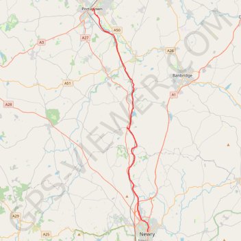
Portadown to Newry by the Newry Canal Towpath
Bike from Portadown to Newry via the Upper Bann, the Cusher River, the Newry Canal Towpath and the Lough Shark. #Bike #River #Canal #Nature #Lake
- Distance : 33,3 Km
- Dénivelé positif : 142 m
- Altitude maximum : 31 m
- Dénivelé négatif : 155 m
- Altitude minimum : 6 m
- Temps en mouvement : 1 h 31 m
- Vitesse en mouvement : 21,9 Km/h
- Vitesse maximum : 47,4 Km/h
- Temps total : 2 h 18 m
- Vitesse globale : 14,4 Km/h
- Date : 11/02/2024
Carte interactive
Profil de la trace GPS
À propos de cette trace GPS
Nom : Trace GPS Portadown to Newry by the Newry Canal Towpath, itinéraire, parcours
Coordonnées : 54.17963 -6.44038 54.42376 -6.33511
Autres traces GPS
Cliquez sur une trace GPS pour visualiser son itinéraire, ses statistiques et son profil.
RT5-1 Rosslare - Kinsale
Distance : 2 860,3 Km • Dénivelé positif : 27 381 m • Altitude maximum : 420 m
CTS-N.Irelandv1.1-Belfast-Titanic>Enniscrone-via antrim coast-209miles
United Kingdom > Northern Ireland > County Down > Belfast
Distance : 335,8 Km • Dénivelé positif : 3 985 m • Altitude maximum : 271 m
TT22 J4 J2/06 : Dublin à Belfast
Irlande > County Dublin > Dublin
Distance : 250,3 Km • Dénivelé positif : 2 609 m • Altitude maximum : 390 m
RT5-1 Rosslare - Kinsale
Distance : 3 867,1 Km • Dénivelé positif : 36 115 m • Altitude maximum : 524 m
Newry Canal Towpath
United Kingdom > Northern Ireland > County Armagh > Portadown
Distance : 32,3 Km • Dénivelé positif : 95 m • Altitude maximum : 29 m