Rando islande
Randonnée pédestre. En aller-retour. #Randonnée
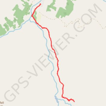
- Distance : 7,3 Km
- Dénivelé positif : 262 m
- Altitude maximum : 277 m
- Dénivelé négatif : 262 m
- Altitude minimum : 95 m
Carte interactive
Profil de la trace GPS
À propos de cette trace GPS
Nom : Trace GPS Rando islande, itinéraire, parcours
Départ : Sturluflöt, Fljótsdalshreppur, Austurland, Islande (64.92790 -15.05851)
Arrivée : Sturluflöt, Fljótsdalshreppur, Austurland, Islande (64.92790 -15.05851)
Coordonnées : 64.90293 -15.06396 64.92802 -15.03826
Topographie : Carte topographique Fljótsdalshreppur