Stoke hartland
- Distance : 18,1 Km
- Dénivelé positif : 629 m
- Altitude maximum : 149 m
- Dénivelé négatif : 589 m
- Altitude minimum : 0 m
- Temps en mouvement : 4 h 50 m
- Vitesse en mouvement : 3,7 Km/h
- Vitesse maximum : 46,1 Km/h
- Temps total : 5 h 47 m
- Vitesse globale : 3,1 Km/h
- Date : 30/03/2024
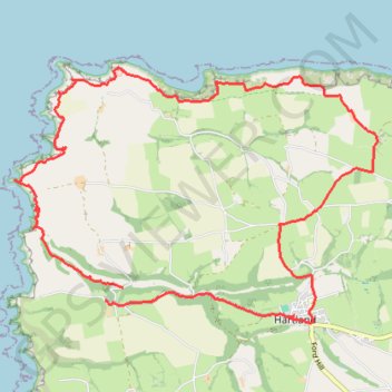
Carte interactive
Profil de la trace GPS
À propos de cette trace GPS
Nom : Trace GPS Stoke hartland, itinéraire, parcours
Départ : Stoke, Hartland, Torridge District, Devon, England, EX39 6DU, United Kingdom (50.99621 -4.51379)
Coordonnées : 50.99197 -4.53365 51.02159 -4.46708
Autres traces GPS
Cliquez sur une trace GPS pour visualiser son itinéraire, ses statistiques et son profil.
Welcombe to Hartland Loop
United Kingdom > England > Devon > Torridge District > Welcombe > Mead
Loop hike from Welcombe to Hartland via Dyer's Lookout, Blackpool, St Nectan's Church, Stoke, Milford, Elmscott, Hardisworthy and South Hole in the North Devon National Landscape. #Hike #Loop #Coast #Sea #Atlantic #Ocean #Nature #Countryside #Cliffs #Overlook
Distance : 25,0 Km • Dénivelé positif : 841 m • Altitude maximum : 166 m