Peter Skene Ogden Trail to the Paulina Lake
Hike to the Paulina Lake by the Peter Skene Ogden Trail along the Paulina Creek via McKay Crossing Falls and Paulina Falls in the Newberry National Volcanic Monument and the Deschutes National Forest. #Hike #Mountain #River #Forest #Falls #Nature #Volcano #Lake
- Distance : 13,7 Km
- Dénivelé positif : 632 m
- Altitude maximum : 1 938 m
- Dénivelé négatif : 9 m
- Altitude minimum : 1 313 m
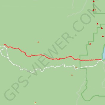
Carte interactive
Profil de la trace GPS
À propos de cette trace GPS
Nom : Trace GPS Peter Skene Ogden Trail to the Paulina Lake, itinéraire, parcours
Départ : Peter Skene Ogden Trail, Deschutes County, Oregon, United States (43.72865 -121.41887)
Arrivée : Deschutes County, Oregon, United States (43.71301 -121.27779)
Coordonnées : 43.71206 -121.41887 43.72880 -121.27779
Autres traces GPS
Cliquez sur une trace GPS pour visualiser son itinéraire, ses statistiques et son profil.
Bend to Alvord Section 1 - Bend to Christmas Valley Sand Dunes
United States > Oregon > Deschutes County > Bend
Distance : 158,7 Km • Dénivelé positif : 887 m • Altitude maximum : 1 559 m
Northern part of the Pacific Crest Trail (PCT)
United States > Oregon > Klamath County
Hike on the Pacific Crest National Scenic Trail from Crater Lake to Canada Border through Oregon and Washington along the Sierra Nevada and Cascade mountain ranges. #Hike #Mountain #SierraNevada #Cascade #Nature #Forest #Park #PCT
Distance : 1 198,3 Km • Dénivelé positif : 44 308 m • Altitude maximum : 2 307 m
Sisters - Ashland
États-Unis d'Amérique > Oregon > Deschutes County
Vélo. En aller simple entre Bend et Ashland. #Vélo
Distance : 473,8 Km • Dénivelé positif : 5 675 m • Altitude maximum : 2 335 m