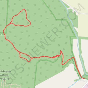
Rhododendron Cove Nature Preserve Trails
Loop hike in the Rhododendron Cove Nature Preserve and the Wahkeena Nature Preserve. #Hike #Loop #Nature #Forest
- Distance : 3,3 Km
- Dénivelé positif : 122 m
- Altitude maximum : 320 m
- Dénivelé négatif : 122 m
- Altitude minimum : 235 m
- Temps en mouvement : 59 m 29 s
- Vitesse en mouvement : 3,3 Km/h
- Vitesse maximum : 11,2 Km/h
- Temps total : 1 h 27 m
- Vitesse globale : 2,3 Km/h
- Date : 25/12/2023
Carte interactive
Profil de la trace GPS
À propos de cette trace GPS
Nom : Trace GPS Rhododendron Cove Nature Preserve Trails, itinéraire, parcours
Coordonnées : 39.63166 -82.56791 39.63735 -82.55925