Wallace Falls
Carte interactive
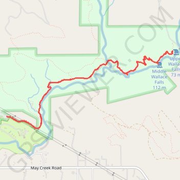
Profil de la trace GPS
À propos de cette trace GPS
Nom : Trace GPS Wallace Falls, itinéraire, parcours
Départ : Woody Trail, Snohomish County, Washington, 98251, United States (47.86702 -121.67814)
Arrivée : Woody Trail, Snohomish County, Washington, 98251, United States (47.86702 -121.67814)
Coordonnées : 47.86552 -121.67814 47.87530 -121.64654
Autres traces GPS
Cliquez sur une trace GPS pour visualiser son itinéraire, ses statistiques et son profil.
Northern part of the Pacific Crest Trail (PCT)
United States > Oregon > Klamath County
Hike on the Pacific Crest National Scenic Trail from Crater Lake to Canada Border through Oregon and Washington along the Sierra Nevada and Cascade mountain ranges. #Hike #Mountain #SierraNevada #Cascade #Nature #Forest #Park #PCT
Distance : 1 198,3 Km • Dénivelé positif : 44 308 m • Altitude maximum : 2 307 m