Hunter Mountain Loop
Loop hike to Hunter Mountain via Lane Road, Becker Hollow Trail, Yellow Connector Trail, Hunter Mountain Fire Tower, Hunter Mountain Trail, Yellow Side Trail and Hunter Mountain Overlook in the Hunter-West Kill Wilderness and the Catskill Park. #Hike #Loop #Mountain #Nature #Forest #Park
- Distance : 7,8 Km
- Dénivelé positif : 688 m
- Altitude maximum : 1 225 m
- Dénivelé négatif : 688 m
- Altitude minimum : 560 m
- Temps en mouvement : 2 h 27 m
- Vitesse en mouvement : 3,2 Km/h
- Vitesse maximum : 5,3 Km/h
- Temps total : 2 h 54 m
- Vitesse globale : 2,7 Km/h
- Date : 06/10/2022
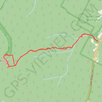
Carte interactive
Profil de la trace GPS
À propos de cette trace GPS
Nom : Trace GPS Hunter Mountain Loop, itinéraire, parcours
Départ : Lane Road, Town of Hunter, Greene County, New York, 12450, United States (42.18170 -74.19713)
Arrivée : Lane Road, Town of Hunter, Greene County, New York, 12450, United States (42.18167 -74.19724)
Coordonnées : 42.17452 -74.23094 42.18356 -74.19713
Autres traces GPS
Cliquez sur une trace GPS pour visualiser son itinéraire, ses statistiques et son profil.