Gorham Mountain and The Beehive Loop (Mount Desert Island)
Loop hike from Sand Beach to Gorham Mountain and The Beehive via Bowl Trail, Beehive Trail, The Bowl, Gorham Mountain Trail, Cadillac Cliffs Path, Monument Cove, Thunder Hole and Ocean Path in the Acadia National Park. #Hike #Loop #Mountain #Nature #Forest #Park #Ocean #Atlantic #Sea, #Lake #Island
- Distance : 6,4 Km
- Dénivelé positif : 265 m
- Altitude maximum : 150 m
- Dénivelé négatif : 266 m
- Altitude minimum : 2 m
- Temps en mouvement : 2 h 40 m
- Vitesse en mouvement : 2,4 Km/h
- Vitesse maximum : 5,3 Km/h
- Temps total : 3 h 7 m
- Vitesse globale : 2,1 Km/h
- Date : 01/06/2023
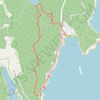
Carte interactive
Profil de la trace GPS
À propos de cette trace GPS
Nom : Trace GPS Gorham Mountain and The Beehive Loop (Mount Desert Island), itinéraire, parcours
Départ : Satterlee Trail, Bar Harbor, Hancock County, Maine, United States (44.33024 -68.18447)
Arrivée : Satterlee Trail, Bar Harbor, Hancock County, Maine, United States (44.33010 -68.18435)
Coordonnées : 44.31658 -68.19334 44.33606 -68.18355
Autres traces GPS
Cliquez sur une trace GPS pour visualiser son itinéraire, ses statistiques et son profil.