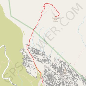
Turtlehead Peak
Hike to the Turtlehead Peak via the Calico Tanks Trail and the Turtlehead Peak Trail in the La Madre Mountain Wilderness and the Red Rock Canyon National Conservation Area. #Hike #Mountain #Nature #Desert #Wilderness #Canyon
- Distance : 3,8 Km
- Dénivelé positif : 577 m
- Altitude maximum : 1 896 m
- Dénivelé négatif : 35 m
- Altitude minimum : 1 318 m
Carte interactive
Profil de la trace GPS
À propos de cette trace GPS
Nom : Trace GPS Turtlehead Peak, itinéraire, parcours
Arrivée : Turtlehead Peak Trail, Clark County, Nevada, United States (36.18023 -115.44598)
Coordonnées : 36.16242 -115.45552 36.18381 -115.44468
Autres traces GPS
Cliquez sur une trace GPS pour visualiser son itinéraire, ses statistiques et son profil.