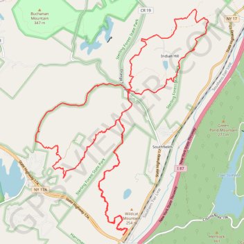
Wildcat Mountain and Indian Hill Loop
Loop hike from Tuxedo Park and Ride via Wildcat Mountain Trail, Townsend Trail, Hall Drive, Furnace Loop, Indian Hill Loop, Hickory Hollow Road and Radio Road in the Harriman State Park and the Sterling Forest State Park. #Hike #Loop #Mountain #Nature #Forest #Park
- Distance : 20,1 Km
- Dénivelé positif : 736 m
- Altitude maximum : 327 m
- Dénivelé négatif : 735 m
- Altitude minimum : 156 m
- Temps en mouvement : 6 h 22 m
- Vitesse en mouvement : 3,2 Km/h
- Vitesse maximum : 21,9 Km/h
- Temps total : 8 h 16 m
- Vitesse globale : 2,4 Km/h
- Date : 03/04/2016
Carte interactive
Profil de la trace GPS
À propos de cette trace GPS
Nom : Trace GPS Wildcat Mountain and Indian Hill Loop, itinéraire, parcours
Coordonnées : 41.22992 -74.20374 41.26791 -74.16512