Lake of the Falls
Lake of the Falls Natural Area. #Hike
- Distance : 16,9 Km
- Dénivelé positif : 899 m
- Altitude maximum : 2 103 m
- Dénivelé négatif : 156 m
- Altitude minimum : 1 359 m
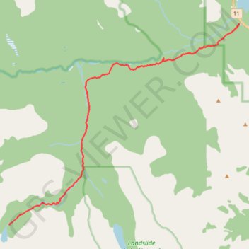
Carte interactive
Profil de la trace GPS
À propos de cette trace GPS
Nom : Trace GPS Lake of the Falls, itinéraire, parcours
Départ : Cline River Canyon Viewpoint, Clearwater County, Alberta, Canada (52.16704 -116.47853)
Arrivée : Lake of Falls Trail, Clearwater County, Alberta, Canada (52.08863 -116.62525)
Coordonnées : 52.08863 -116.62525 52.16714 -116.47853
Autres traces GPS
Cliquez sur une trace GPS pour visualiser son itinéraire, ses statistiques et son profil.