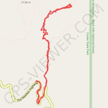
Cathedral Spires
Hike to Cathedral Spires in the Custer State Park. #Hike #Mountain #Nature #Forest #Park
- Distance : 4,9 Km
- Dénivelé positif : 243 m
- Altitude maximum : 2 042 m
- Dénivelé négatif : 241 m
- Altitude minimum : 1 899 m
- Temps en mouvement : 1 h 50 m
- Vitesse en mouvement : 2,7 Km/h
- Vitesse maximum : 12,3 Km/h
- Temps total : 2 h 24 m
- Vitesse globale : 2,0 Km/h
- Date : 14/08/2023
Carte interactive
Profil de la trace GPS
À propos de cette trace GPS
Nom : Trace GPS Cathedral Spires, itinéraire, parcours
Départ : The Needles Highway, Custer County, South Dakota, United States (43.84230 -103.53665)
Arrivée : The Needles Highway, Custer County, South Dakota, United States (43.84228 -103.53672)
Coordonnées : 43.83976 -103.53679 43.85087 -103.53112