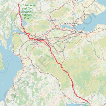
United Kingdom to Beinglas Campsite
- Distance : 215,4 Km
- Dénivelé positif : 1 837 m
- Altitude maximum : 318 m
- Dénivelé négatif : 1 833 m
- Altitude minimum : 0 m
Carte interactive
Profil de la trace GPS
À propos de cette trace GPS
Nom : Trace GPS United Kingdom to Beinglas Campsite, itinéraire, parcours
Départ : A74(M), Kirkandrews, Dumfries and Galloway, Écosse, DG16 5JD, Royaume-Uni (54.99482 -3.05256)
Coordonnées : 54.99482 -4.72627 56.33179 -3.05256
Topographie : Carte topographique Dumfries and Galloway
Autres traces GPS
Cliquez sur une trace GPS pour visualiser son itinéraire, ses statistiques et son profil.
Lowther hills hillwalk
United Kingdom > Scotland > Dumfries and Galloway
Distance : 13,3 Km • Dénivelé positif : 594 m • Altitude maximum : 731 m